|
The Equatorial Bulge Climbing Ecuador's Volcanoes February 27th, 2006
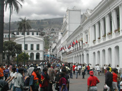
So you're an aspiring mountaineer? You've climbed some snow or ice routes in the Alps or Pyrenees. You've got glacier travel and crevasse rescue covered. Now you want to test your skills at higher elevations, organize your own mountaineering expedition and, perhaps, immerse yourself in culture? There's no better place than Ecuador. A successful first big-mountain expedition generally requires three things: good weather, easy access, and reliable beta. Ecuador doles up the first two requirements in spades. And now, with this article, you have the third. What follows is a detailed account of how to plan your mountaineering visit to Ecuador, complete with the latest route descriptions available for the most popular volcanoes. All of this information is totally current; most of it does not yet exist in any guidebook. Quito Acclimatization Peaks
For a more adventurous outing, go farther south of Quito to Corazon (15,700 feet), which, due to its central location in the Andean chain, offers spectacular mountain vistas in every direction. Corazon requires as much as 5,400 feet of elevation gain, depending on where your ride drops you off. While there is a dirt road leading to 13,500 feet on the east side of the peak, it is wilder and more fun to shortcut straight up the switchbacks, bushwhacking through dense patches of scrub, grass, and eucalyptus. There are several false summits to overcome before the main summit, which is on the rim of a huge caldera. Although it is only a class 2 climb, Corazon is a physically challenging mountain that will make any visitor feel like Indiana Jones! The beautiful Iliniza Norte (16,800 feet) is the highlight of the acclimatization regimen, but requires an overnight stay at the Iliniza hut. The hut, a two and a half hour hike from the trailhead, is situated at 15,200 feet, in the saddle between Iliniza Norte and its twin sister, Ilinza Sur. The climb involves a lot of steep trail hiking and enjoyable class 3 scrambling on surprisingly solid volcanic rock. The route snakes its way from the south face of the peak around to the north. Due to the presence of false trails and cairns, visitors climbing without a guide should be very adept at route-finding. If there is snow or rain, the technical difficulty can easily increase to low class 5. In such conditions, the slightly lower and easier west summit is usually the objective of choice. Either way, Iliniza Norte makes a splendid acclimatization climb. Page 2 »
|
|||